US Military: Finding Surface-to-Air Missile Sites with AI Algorithm
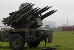
National intelligence agencies usually have a group of well-trained analysts who use various data interpretations to find nuclear facilities in other countries or hide in secret military locations in terabyte satellite images. Now the deep learning algorithms trained by American researchers are hundreds of times faster than humans in identifying locations where mainland surface-to-air missiles are located. According to Wired, scientists at the University of Missouri found that deep learning algorithms can help people without experience in image analysis to find a surface-to-air missile site spread over nearly 90,000 square kilometers in the southeastern part of the continent. (AI) The overall accuracy of positioning missile sites has reached 90%, human identification requires 60 hours, and artificial intelligence takes only 42 minutes. The importance of this research is that artificial intelligence has proven to reduce the burden on analysts. Commercial satellite image company DigitalGlobe generates approximately 70TB of original satellite image per day, not to mention the huge image data of other commercial satellites and government spy satellites. Researchers use off-the-shelf deep learning models to identify objects that may be of interest to intelligence agencies and national security experts. Deep learning models, including GoogleNet and Microsoft's ResNet, were originally created to detect and classify objects in traditional photos and audiovisual images. The researchers used these existing deep learning models to identify the color captured by the satellite. And black and white images. Analysts have identified most of the existing surface-to-air missile sites, but similar deep learning tools can automatically mark new ground-to-air missile sites in North Korea or other countries, and there may be high near the location of surface-to-air missile sites. Value assets, so new sites are often the part of the analyst's interest. The main problem in applying artificial intelligence to satellite image analysis is the lack of a large training database, including examples of manual tagging required to train deep learning algorithms to accurately identify satellite image features. The University of Missouri team used DigitalGlobe satellite imagery to combine public data from approximately 2,200 surface-to-air missile sites around the world, build a training data, and then test four deep learning models to find the best performing model. Current deep learning algorithms face greater challenges in analyzing smaller objects such as mobile missile launchers, radar antennas, mobile radar systems, and military vehicles because the resolution of these images in satellite images is too low. However, artificial intelligence tools have been very helpful in intelligence gathering. For example, the International Atomic Energy Agency (IAEA), in addition to monitoring all declared nuclear facilities, needs to find undeclared facilities in nearly 200 countries, deep learning tools. It can help the IAEA and other independent organizations monitor nuclear power development and related weapons of mass destruction. Stainless Steel Stamping Belt,Industry Stainless Steel Conveyor Belt,Stainless Steel Strips For Furniture,Portable Food Industry Conveyor Belt ShenZhen Haofa Metal Precision Parts Technology Co., Ltd. , https://www.haofametals.com